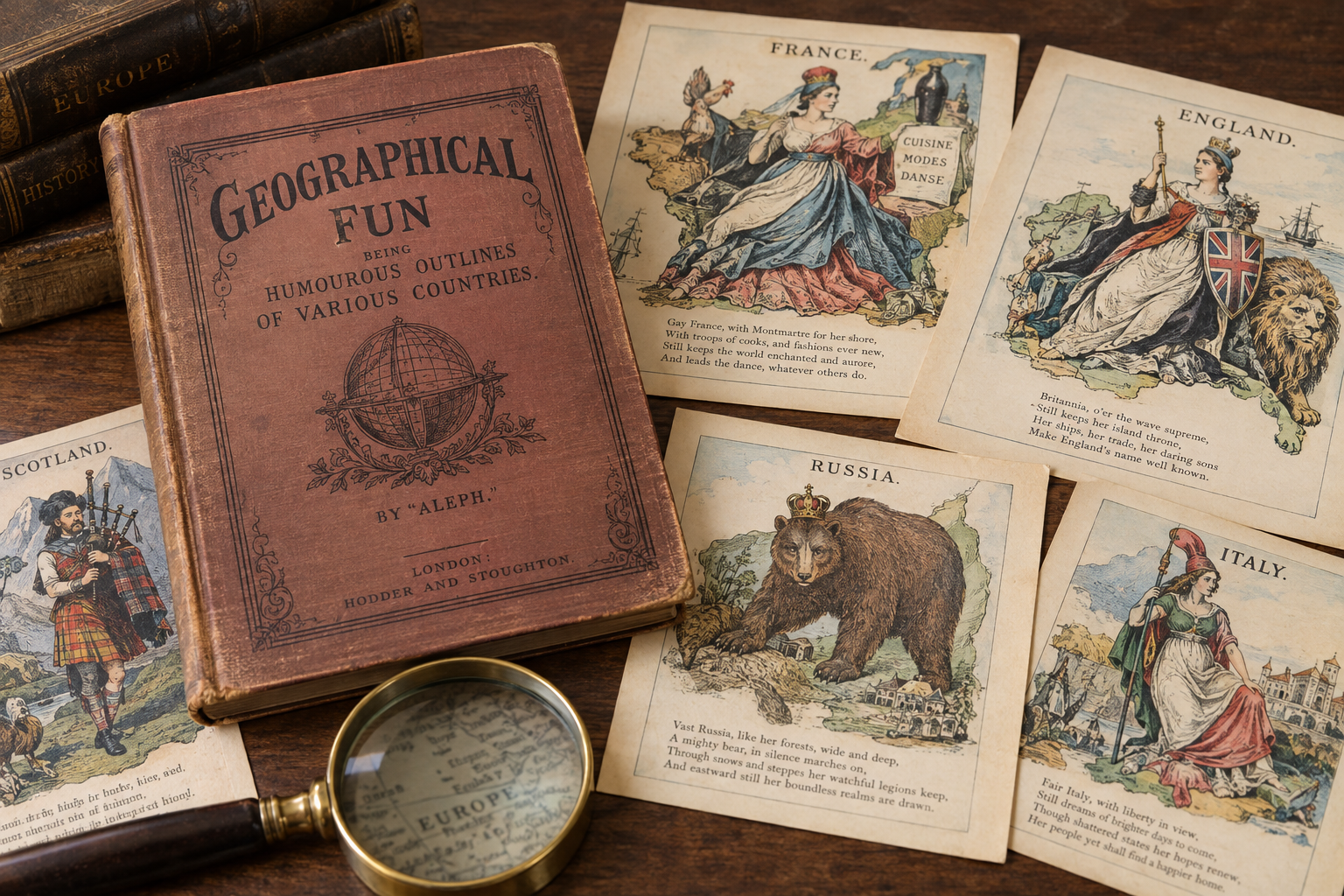
Victorian-era maps in Geographical Fun, published by London firm Hodder and Stoughton in the 1860s, personify European countries as caricatures with witty four-line verses. Their artist is disputed. The title page credits 'Aleph,' the alias of surgeon William Harvey, and recent mentions name him as artist, but the sources do not settle the question.
A series of Victorian-era maps that personify European countries as caricatures is getting new attention, along with a question about who actually drew them. The collection, titled Geographical Fun: Being Humourous Outlines of Various Countries, was produced by London publisher Hodder and Stoughton in the 1860s. Each map carries a witty four-line verse. The Library of Congress holds separate prints of the plates, and the full book is available on the Internet Archive.
Who drew the Victorian map caricatures of Europe?
The book's title page credits the introduction and descriptive lines to "Aleph," the alias of London surgeon and "frequent contributor to periodical literature" William Harvey. Several recent mentions of the book name Harvey as the artist behind the maps. The author of the source material questions that claim, and the strongest evidence against it comes from Harvey's own opening lines.
Harvey writes that "the young lady who is responsible for these Sketches is now in her fifteenth year." He says her first idea for map drawing came from a small figure of Punch riding a dolphin, which she turned into a representation of England. She sketched it, he writes, to amuse a brother who was confined to bed by illness.
Harvey also describes the book's purpose as educational and says he hopes it might "prove of service to young scholars." That leaves room for a different reading. The teenage sketcher could be a device meant to build a closer bond with a young audience, though the source calls that idea a little far-fetched. Taking Harvey at his word would mean the figures were the work of a teenage girl, possibly a family friend or even his own daughter, who preferred to stay out of the spotlight.
What do the Victorian Europe caricature maps show?
The Library of Congress describes the twelve plates that follow in some detail. England appears as Queen Victoria. Scotland is shown as a gallant piper struggling through the bogs, and Wales as Owen Glendower. Ireland is a peasant, happy in her baby's smile. France is an empress of cooks, fashions and the dance. Spain and Portugal are joined in lasting amity, and Italy is a revolutionary figure wearing a liberty cap. Prussia is represented by Friedrich Wilhelm and Prime Minister Bismarck. Holland and Belgium appear as female figures, Denmark as a woman on ice skates, and Russia as the classic bear.
The verses and plates make the series' playful tone clear, but the sources do not settle who drew the figures. The Library of Congress record and the book's title page point in different directions, and the introduction gives a third account. Until a clearer record turns up, the maps remain a curiosity with an unresolved authorship question.
Este artículo fue escrito con la asistencia de IA.
News Factory APP - noticias agénticas para impulsar tu SEO y AEO.